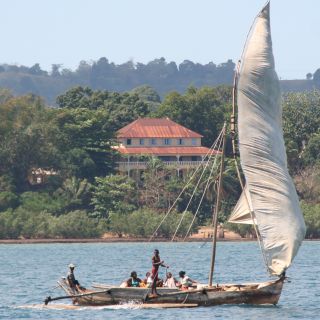
Coastal dhow running before a stiff breeze
Madagascar Coast
 Coastal dhow running before a stiff breeze |
18 November 2007, Inhambane Bay, Mozambique
Dear Friends and Family,
The colorful dhows that sail all around this western coast of Madagascar are wonderful! They come in many sizes, from small fishing boats to larger local "freighters" of perhaps 60' (18m) long. Open decked, with a cutoff stern and solid but crude planking, they have a stubby mast that's raked forward. The single triangular sail is hung from a long yard or pole - usually several sticks lashed together - that runs from the bow, past the top of the mast and high up over the stern. The sails are huge and often have more patches than original cloth. They can't tack them, but they wear them around very quickly. Even the tiny dugout-canoe outriggers often have a small square sail, held up with two sticks. The winds here blow from the east in the morning and from the west in the afternoon, and these boats make the most of it. Very pretty to watch so many of them sailing to and fro between the islands.
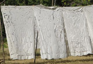 Beautiful Drawn-thread table-cloths |
Our passports went walkabout when we returned from our inland Madagascar trip, which caused much pandemonium on Ocelot. Jon still had his UK passport, but getting 2 new 1‑year (only) passports from the US Consulate in the capital of 'Tana would cost over US$1,000. So on Wednesday, October 24 we checked out (using only our police report) and sailed next door to Nosy Komba (Nosy means Island) at 13°26.5'S 48°21'E. They do wonderful embroidery and drawn‑thread work there. We traded some wood-carving tools for some nice carvings and took a lovely hike up into the hills under the cool trees.
On Thursday we sailed to the wonderfully clear water at Tanikeli Island (13°29'S 48°14'E) to go snorkeling and scrub the grass off Ocelot (our version of mowing the lawn...). After lunch we pushed on to Russian Bay (13°32'S 48°01'E) for the night. Apparently the bay got its name just after the turn of the century, when the crew of a Russian ship saw the women here and decided to settle down, making occasional pirating forays out into the channel until they ran out of fuel.
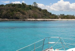 The glorious water at Tanikeli Island |
On Friday 26 October we had a delightful sail down the coast (our first real sailing day in ages) ending up in "Honey" (Baramahamay) Bay at 13°43'S 47°54'E. Sue and Jon went ashore to talk to the villagers and trade for some of the honey they collect in the mountains. Great wild honey, with a very different taste. Even better, while we were gone, Amanda found our passports! This will make our entry to South Africa and subsequent touring much easier. How they made their way into the sewing bag(!?) we may never know. Since Sue was responsible for them, the event is not being investigated. The official cause is Gremlins...
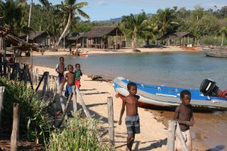 "Honey" (Baramahamay) Bay village and kids |
We're feeling a bit alone out here as there are no cruising boats heading our way. Hopefully we'll find some before we leave Madagascar. On Saturday 27 October we left before breakfast but only found light headwinds until almost noon. Then the wind died and came up again from the WNW and we had a glorious sail, even flying the chute for an hour or so. We sailed past several islands, dodging in and out. Our electronic charts aren't that dependable here, but we have accurate GPS tracks from other boats that have been here before us, so we can usually keep ourselves out of trouble.
We eventually ended up at Nosi Shaba (14°22'S 47°38'E) a cute little island with a nice deserted beach, glorious water, and protection from the westerly winds. Winds here are interesting - they usually blow one way in the morning and the opposite direction in the afternoon. We were told these were onshore/offshore, but they seem to us to run up and down the coast. Luckily, the morning winds (which are usually against us) have been much lighter than the afternoon winds.
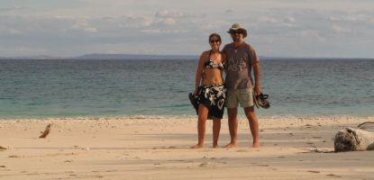 Jon & Amanda on Nosi Shaba - Madagascar mainland behind |
In Nosi Shaba we met up with a South African catamaran named Irene, which is headed our way. It's always much more fun cruising with another boat for company.
We had an interesting night ... About 10pm, Sue and Amanda were watching a movie when they realized the wind had switched 180° and we were now stern to the rocks in 10' (3m) of water. Yikes! Time to get out of there. So we pulled up the hook and headed into the wind towards the dark mainland, about 5 miles away. Nosing around along the shore we eventually found ourselves a reasonable anchorage to spend the rest of the night in, but it took a while for the adrenalin to die down. Both of the 2 other boats that were anchored with us left about an hour later, headed in different directions. Not fun.
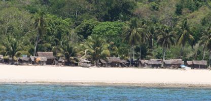 Typical Madagascar fishing village |
That morning, Sunday 28 October, we left at 6:30am. The wind was still blowing from the south and we had a glorious sail SW for 43 miles to Moramba Bay. The only difficulty was that the wind strength kept changing (11‑27 knots) requiring Amanda and Jon to take first 1, then a second reef, shake them both out, and then reef again. But the wind was blowing from shore so there was no "fetch" to build up waves. Ocelot loves flat water and we had a wonderful sail, zooming along happily and watching the dry coast and small villages of Madagascar slip by.
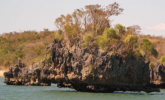 Wild rock formations in Moramba Bay |
By 2:30pm we anchored in Moramba Bay (14°54'S 47°20'E). The scenery is pretty wild - we're surrounded by rocky limestone islands, severely undercut by the ocean so the little ones look like they're standing up on pinnacles (like something out of the computer game Riven). The edges of the islands are deeply scarred by the rain, but they have thick dry-jungles on top, including small Baobab trees! Very other-worldly.
Even more fun, we're here with 3 other cruisers! Irene, the catamaran we met yesterday got caught in the same wind-shift as us and decided to sail down in the night. The monohulls Kyena 2 and Abracadabra (we know both from Chagos) have been here for a few days. We're all headed down the coast and getting ready to cross the channel to Mozambique and South Africa, so we'll compare notes on the best routes and strategies. Should be fun!
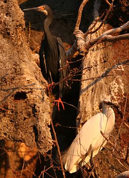 Both the white & dark versions of the Dimorphic Egret |
The next day we took the dinghy out to explore these wild islands we're anchored next to. The bird life was awesome: Madagascar fish eagles, dimorphic egrets, and huge black Vasa parrots. One of the first things we found was a cave ... with human(!) bones in it. Obviously, one of the local villages uses it for special people. This makes the cave "fady" or taboo, so we left quickly. Then we had a lovely BBQ on the beach with the 3 other cruising boats here - a very yachty affair, with way too much good food, drink, talk, and fun times.
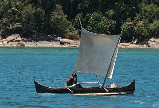 Tiny outrigger pirogue sailing happily |
The next morning we followed Abracadabra out and had a lovely sail down the coast, but the anchorages are starting to get few and far between. We ended up stopping in Mahajamba Bay (15°17'S, 46°59'E) about 25 miles down the coast but Abracadabra continued on (which we found rather strange, as they couldn't get to the next anchorage in daylight). Very little here, but a convenient place to stop as we day‑sail down the west coast of Madagascar & we enjoyed our afternoon here in glorious isolation. Later in the afternoon we took a big bag of clothes to the village ashore and they were very excited - it looked like Christmas on the beach. So as not to make a one-way gift, we asked for a few mangoes, which produced the biggest fruit we'd ever seen. Yum!
Our next bay was the bustling port town of Majunga, but Majunga has a bad reputation. Just a few weeks ago a Canadian couple was beaten there and their boat ransacked. This is always infuriating, as nothing much thieves can take from a boat has any value when removed. But we wanted to top up our diesel tanks before making our 1,000nm passage to southern Africa, and Majunga is the only place to do that.
So we left Mahajamba Bay at 5am and had a delightful sail down the coast, 60nm to Majunga. We arrived at 3pm, dropped the dinghy, loaded it with fuel jugs, and headed for shore. On our way we talked to the only other yacht in the anchorage and they told us they'd been robbed of their diesel jugs just a few nights before, despite sleeping with cockpit lights on and hatches locked. Not a good place. So Jon watched Ocelot while Sue and Amanda found a taxi, changed money, and bought diesel. As soon as they returned we skedaddled 5 miles across the bay to a local sugarcane village. Going ashore we talked to people and they knew nothing about the troubles in Majunga, but said their side of the bay had no problems. Nevertheless, we left the cockpit lights on and setup our intruder alarm, picked up in Venezuela in 2002 and rarely used since. No problems and we again left at 5am, before the sun was up.
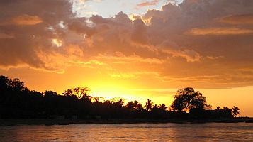 Madagascar coastal sunset |
We had another wonderful sail, watching the sun rise as we motored out of Majunga Bay and then setting the spinnaker in the light morning breeze. Lots of colorful local dhows sailing around and even some gaff-rigged schooners. We caught a pair of nice 3' (1m) barracudas, so we had fish to share. We anchored in Bali Bay at 16°0'S 45°17'E, about 50 miles ENE of Cape St. Andre. The cape forms a nose, about 85nm north of the westernmost point of Madagascar. Bali Bay is about the last decent anchorage along this coast and it's the traditional jumping off point for boats heading for Mozambique and South Africa.
In Bali Bay we met up again with our cruising friends Irene and Kyena 2 from Moramba Bay. We spent a day or so checking everything and getting Ocelot (and us) ready for our passage before jumping off. What forecasts we had said that the winds in the Mozambique channel should come from the NE starting in a day or 2, mostly on the Mozambique side but they should last for several days.
We held a fun 3-boat pot-luck and strategy meeting on Ocelot (of course) the night before we left. Our passage notes from the crossing are in our Mozambique Channel newsletter.
Fair winds and calm seas -- Jon, Sue and Amanda Hacking
Top Level: Home | Destinations | Cruising Info | Underwater | Boat Guests | Ocelot | Sue | Jon | Amanda | Chris | Site Map | Make a Comment
|
If our information is useful, you can help by making a donation |
Copyright © 2000‑ Contact: Jon and Sue Hacking -- HackingFamily.com, svOcelot.com. All rights reserved.